 Top of Part 3
 Previous p.
 Next page
| 3 - 9 |
Growth and collapse of lava dome (Period 1) |
|
Top of Part 3
Previous p.
Next page
|
|
|
The first lava dome a day after the emergence
60m in diameter. The eastern edge of the Jigokuato crater is on the right. (21 May 1991) |
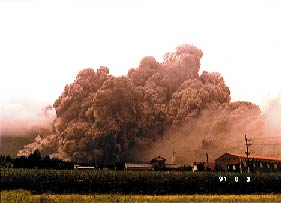
Ash cloud of the large-scale pyroclastic flow
on 3 June
Occurred at 16:08. Speed was about 130 km/hour. Hit the Kamikoba area in 2 minutes. (taken by Dr. Ono, Kyoto Univ.) |
|
|
|
|
The lava dome just after the pyroclastic flow
on 3 June
At the ruin of collapse of the dome has already come up new lava. Left is the east. (4 Jun. 1991) |
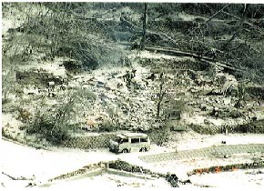
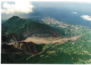
The whole view of the Kamikoba area, the Shimabara City
just after the hit by the pyroclastic flow
on 3 June
The pyroclastic flow itself descended for 3.5 km. Its ash-cloud surge hit 700 m further. (4 Jun. 1991) |
|
|
|
|
The fixed point just after the large-scale pyroclastic
flow on 3 June
Press reporters were used to take pictures at this point located inside the area from which residents were advised to evacuate. Trees and houses were completely destroyed. (4 Jun. 1991) |
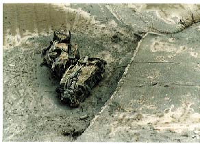
Cars burned by the pyroclastic flow on 4 June
These were blown off by ash-cloud surge due to the pyroclastic flow. (5 Jun. 1991) |
|
|
|
|
Top of Part 3
Previous p.
Next page
|
The second large-scale pyroclastic flow occurred on 8 June 1991. |
|
Lobe #2-A just before the collapse in large scale
Half a day later, collapse of this lobe caused a large-scale pyroclastic flow. (8 Jun. 1991) |
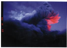
Explosive eruption
Because the exit of the magma conduit was opened after the collapse of the lobe, the magma was bubbled and blew off bombs. (20:10 on 8 June 1991; taken by K. Nishikawa, the Shimabara City) |
|
|
|
|
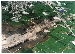
Kamikoba, Shiratani and Tenjinmoto areas
in the Shimabara City just after the pyroclastic flow
on 8 June
(9 Jun. 1991) |
Around the front of the pyroclastic flow on 8 June
It descended down along the Mizunashi River and reached 5.5km far from the crater. This is 30m before the Rout 57. (9 Jun. 1991) |
|
|
|
|
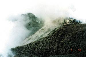
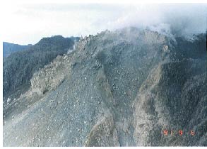
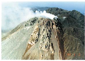
View of lava domes from the northeast side
The lobe #2 grown on the eastern flank (left: about 450m in length) and the lobe #3 on the top of the summit (about 250m in diameter). (19 Aug. 1991) |
View of lava domes from the south
The lobe #3 (upper) grew over on the top of the lobe #2 (lower). (24 Aug. 1991) |
|
|
|
|
Top of Part 3
Previous p.
Next page
|
|
|
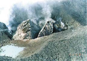
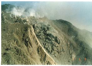
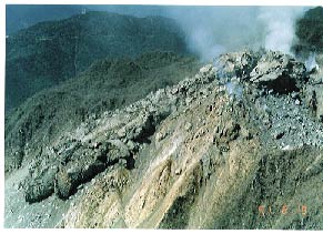
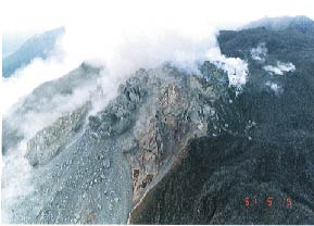
Lobe #3 just before the large-scale collapse
The exit of the conduit for the lobe #3 moved to the northeast side. (15 Sep. 1991) |
Lobe #3 just after the large-scale collapse
The ruin of the big collapse at 18:54 on 15 Sep. 1991. Left is the lobe #2. (16 Sep. 1991) |
|
|
|
|
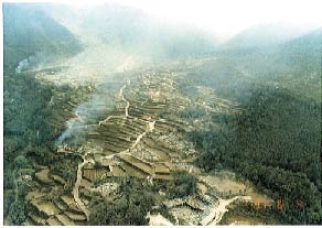
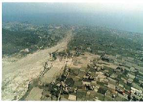
The area suffered by the large-scale pyroclastic flow
on 15 Sep.
The main flow ran along the Mizunashi R. but the ash cloud rushed straight to hit the Onokoba Area, Fukae Town. (22 Sep. 1991) |
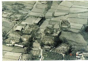
Around Onokoba Elementary School
burned by the large pyroclastic flow
(17 Sep. 1991) |
|
|
|
|
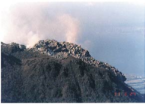
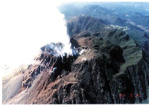
Northeast view of domes
Somewhat old Dome #4 is on your side. Left is Dome #6 on growing. (10 Mar. 1992) |
Northeast view of the summit of Mt. Fugen
You can find old domes formed inside basin-like Myoken Caldera. New domes have grown on the east flank. On your side you can see Furuyake lava as well. (24 Aug. 1991) |
|
|
|
|
Top page of Part 3
Previous page
Next page
|