Top of Part 4
 Previous p.
 Next page
|
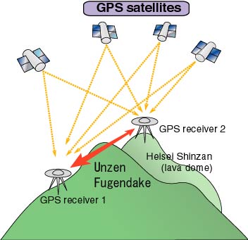
GPS (Global Positioning System)
is a device that gives,
for example, a
traveling motorcar
or airplane
its exact position
on the Earth
by receiving radio waves
simultaneously from
four satellites out
of twenty-four which
launched by United States.
By interference
of the waves received
simultaneously at two different
stations,
we can measure the distance
between these stations
exactly to one
centimeter.
Accordingly, GPS is
widely employed
for geodetic survey and
also for estimation
of a rate of plate movement.
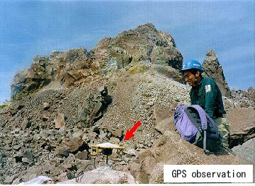
At Unzen Volcano
we set GPS receivers on
and around the lava dome and kept
watching of the movement
of the lava dome and
the surrounding ground.
During explosive periods,
we frequently detected
inflation of the volcano
due to the ascent
of a large mass
of magma through the vent.
Furthermore,
we observed that
the lava dome was
shrinking by cooling and
sliding down on the east
slope of the volcano
even after the cessation of
explosive activity.
|